Maps Page on Argentina
Outline
1.
Physical Environment
o Argentina Terrain
o Argentina Soils
o Physical Map of Argentina
2.
Weather & Climate
o Argentina Precipitation
o Argentina Climate Zones
o Argentina Annual Average Temperatures
3.
Human Environment
o Indigenous People of Argentina
o Population Density of Argentina
o Argentina Provinces by Flags
4.
Road Maps
o Buenos Aries Road Map
o Cordoba Road Map
o Mendoza Road Map
5.
City Maps
o Mendoza
o Buenos Aries
o Rosario
6.
Urban Transportation
Maps
o Buenos Aries Bus Line
o Buenos Aires Underground Subway
o Mendoza Bus Line
7.
Tourist Maps
o Perito Moreno National Park Map
o Tierra del Fuego National Park Map
o Iguazu Falls
1 Physical Environment
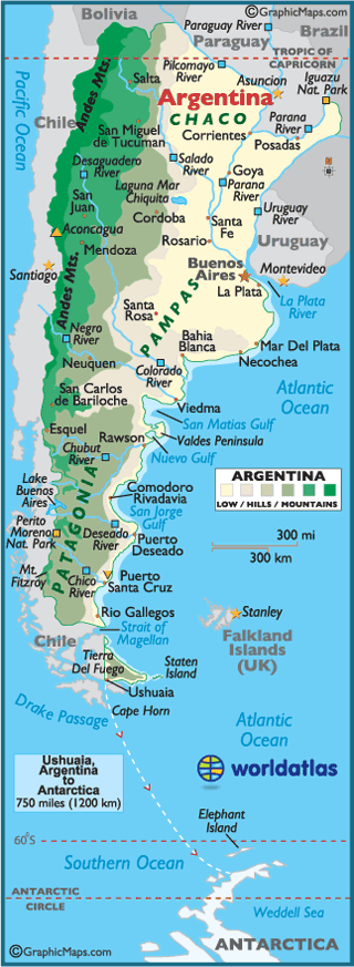
https://www.worldatlas.com/webimage/countrys/samerica/argentina/arland.htm
The map above from the World
Atlas shows the physical differences throughout Argentina. The Andes mountains
are along the west coast and the eastern coast is lower.
.png)
https://library.wur.nl/isric/fulltext/isricu_t4d6e5d51_001.pdf
The soil distribution in
Argentina also varies with the physical differences. Above is a map detailing
the different types of soil in Argentina.
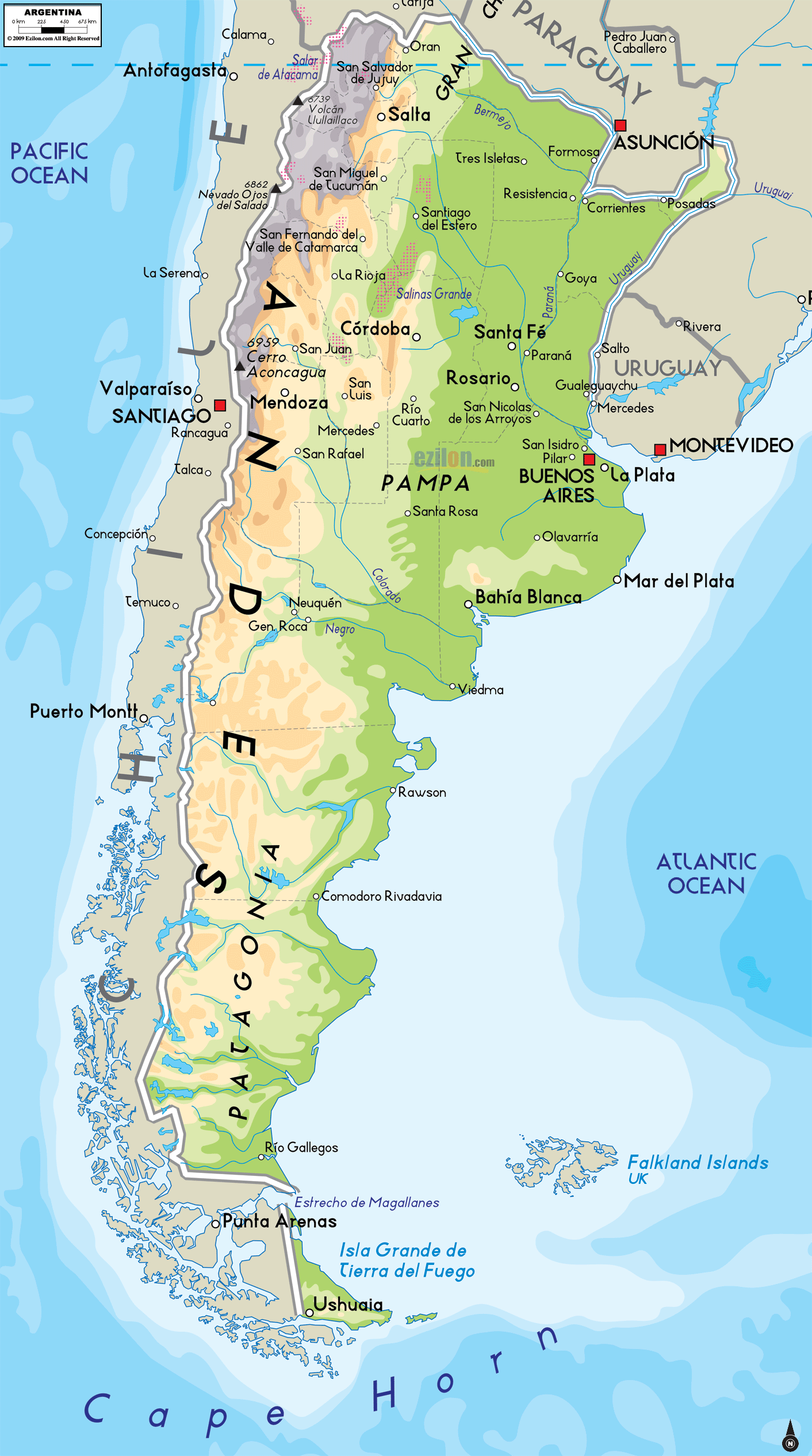
https://www.ezilon.com/maps/south-america/argentina-physical-maps.html
This is just a basic
physical map of Argentina above.
2 Weather & Climate
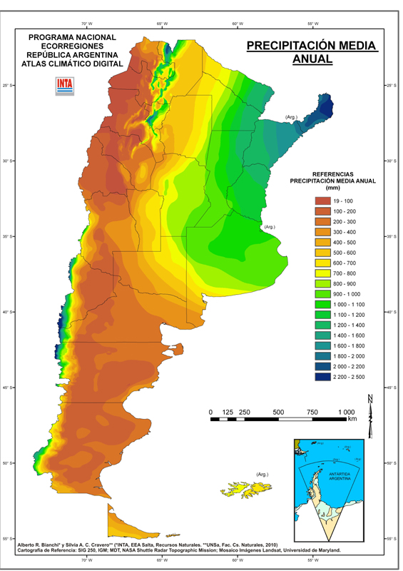
http://anterior.inta.gov.ar/prorenoa/info/resultados/atlas_climatico_arg/atlas_clima_arg_preci.htm
The precipitation in
Argentina ranges widely based on the different areas of land. Above, the map
shows the precipitation of Argentina.
.png)
https://upload.wikimedia.org/wikipedia/commons/9/96/Argentina_mapa_climas.svg
The map above details
Argentina�s differing climate types. The size of Argentina allows for a large differentiation
throughout the country.
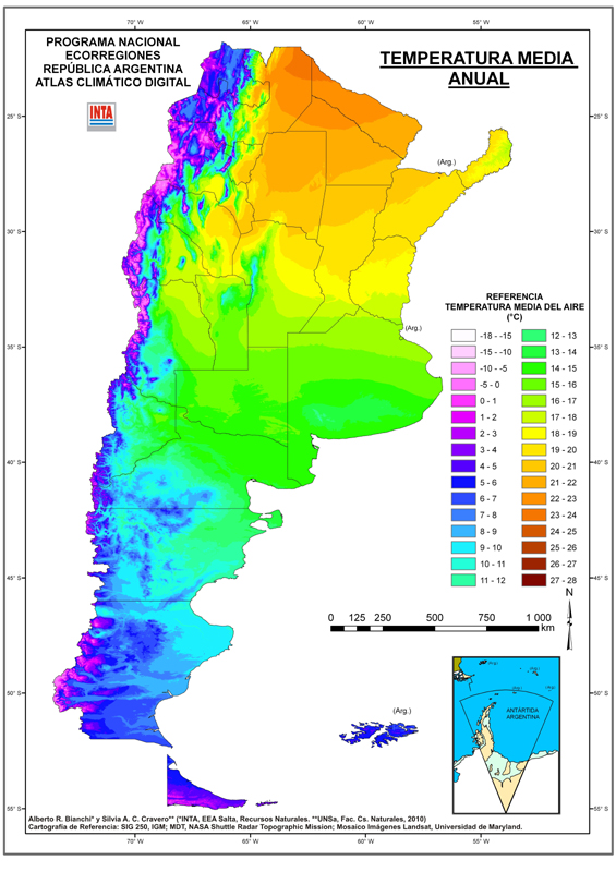
http://anterior.inta.gov.ar/prorenoa/info/resultados/atlas_climatico_arg/atlas_clima_arg.htm
Temperature also ranges
greatly depending on the area. The Patagonia tends to be cooler, as well as the
Andes. Mid-range to northern Argentina tends to be warmer. The map above shows
the mean annual temperature throughout Argentina.
3 Human Environment

https://upload.wikimedia.org/wikipedia/commons/4/47/AborigenesDistribucion.jpg
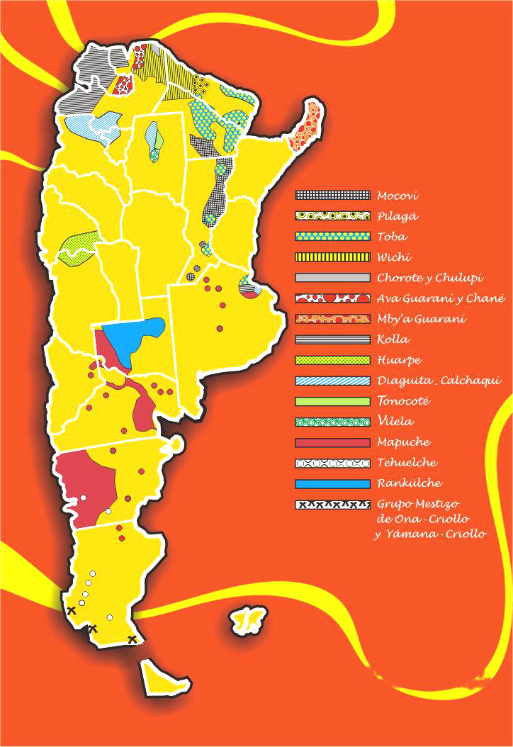
Although it is not the
most pleasing to look at, the map above shows the differing populations of indigenous
people in Argentina. Unlike its neighbors, Argentina has a lower population of
native people.
.png)
http://worldpopulationreview.com/countries/argentina-population/
The map above shows the
population density of Argentina. Buenos Aries stands out as having a large
portion of the total population.
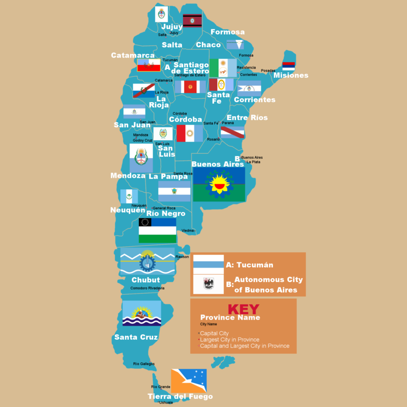
Argentina is broken into
23 provinces with one autonomous city (Buenos Aires). Above, the map shows the borders
of each province, with flag to delineate each province.
4 Road Maps
.png)
https://www.google.com/maps/@-34.6333341,-58.5569512,11.54z?hl=en-US
Above is a map of the
streets of Buenos Aries. When clicking on the link the map is interactable.
.png)
The map above features
the city of Cordoba. It is a more central city in Argentina.
.png)
Another map of Mendoza, featuring
the roads throughout the city.
5 City Maps
.png)
https://www.mapquest.com/argentina/mendoza-282122192
Mendoza is one of the
larger cities in Argentina. Above is a map showing a satellite view of the
city.
.png)
Buenos Aries is the
capitol of Argentina and the largest city of Argentina. The map about shows a
satellite view of the Greater Buenos Aries area.
.png)
Rosario is a port city
along part of the Entre Rios River. The map above shows a satellite view of the
city and nearby river.
6 Urban Transportation
.png)
https://www.omnilineas.com/argentina/buenos-aires/bus-line/1/
The map above shows the
1st line of buses, and locations of bus stops in Buenos Aries.
Interaction is available for bus lines, subway lines, and train lines, and
allows destination markers to be selected.
.png)
https://www.metrolinemap.com/metro/buenos-aires/
The Metro Line map shows
the underground subway system throughout Buenos Aries. Each line is delineated
with a different color, as well as each stop being symbolized as well.
.png)
https://moovitapp.com/index/en/public_transit-line-126-Mendoza-4007-1398602-5988170-0
The map above highlights
the 126-bus route in Mendoza, Argentina. The red shows the roads the bus
travels along, while the dots show the individual stops taken by the bus.
7 Tourist Sites
.png)
http://lessismaurferias.blogspot.com/search/label/13-11%20PATAGONIA
The map above is of Perito
Moreno National Park, specifically the glacier. It details the mountain ranges and
parts of the glacier as well as surrounding area.
.png)
https://mapcarta.com/Tierra_del_Fuego_National_Park/Map
Although it is not easy
to see in the screenshot, the map above shows Tierra del Fuego National Park.
When on the actual site the map is interactable and includes different layers
of information the user can switch on and off. The one in the picture is the
terrain layer.
.png)
Iguazu Falls is
possibly one of the most popular tourist destinations for Argentina. The map
above show what a tourist would get on arrival to the falls. It is not
incredibly accurate, but it helps with general locations of buildings and
activities.
Submitted by Sabrina Short on 03/06/2020.